
| ispaTool | ||
|
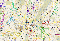
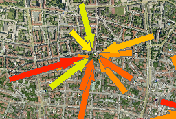
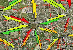
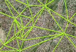
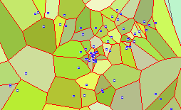
What can ispaTOOL do for you? IspaTOOL is a fully integerated Extension - Add-In - for the leading geographical information system ESRI's ArcGIS 10 . ispaTOOL contains an usefull tool set to conduct additional analysis and a better visualisation of your data. Spider diagram und Distance matrix ! ispaTOOL provides you a function to connect two different layers - point, polyline and polygon. You define if you want one or more connections. For each combination a line is created. You can combine it with additional data and display on the map. ispaTOOL gives a better picture ! The visualisation of lines is never satisfying you? Yes its true: it is very limited. ispaTOOL is converting lines into arrows. This arrows can be adopted to your needs in many ways. The arrows are keeping its line information and as an polygon you have all options to symbolise the arrow on the map as well as editing the shape, angle and location. New visualisation options with ispaTOOL ! With doubble arrows you can strikingly symbolise floating information like "Pump-In und Pump-Out". The manifold visualisation options of the arrows are remaining. Delauney triangulation is a perfect basis for new analysis and visualisation with arrows ! ispaTOOL creates from a Layer - point, polyline or polygon layer - a Delauney-Triangulation. Result is a line network as well as the polygons between the (center-) points. For each line an identifyer of the start and the end point is saved. In this way you can easily use your data in the network for continuative analysis. ispaTool can do ... more: Convexe hull and Thiessen - or Voronoi polygons. Often used is the dispartment of the space between points or the information which area is covered by a bunch of points. ispaTOOL is generating this information in form of polygons saved in a file-geo-database. As usual for an ispacom product the data is open and ready for further analysis and better visualisation on the map. Expert or beginner - ispaTOOL makes sense ! Use this Add-In as nucleus for a new GIS-solutiuon or simply as usefull add-on. Please contact our team for further information. |
     |
![]()