
| ispaCOMB | ||
|
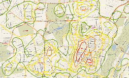
What can ispaCOMB do for you? IspaComb is a fully integerated Extension - Add-In - for the leading geographical information system ESRI's ArcGIS 10 . ispaCOMB is containing a usefull tool set to analyse and visualise point information into space. Get more information from your data ! ispaCOMB is not only providing various options to extrapolate your point data into space. On top this Add-In enables you to combine information from different layers and sources and display the result on one map. ispaCOMB is the first raster spatial analysis tool able to bend the space ! Old fashioned raster analysis tools are calculating on basis of euclidean distances. ispaCOMB is able to import calculated costs between the points like distance based on the street network or drive time. Any of this distance matrices deliveres a much better and realistic result. Even complex models integrating wind and slope can be used as basis for your analysis and visualisation. Use the smart allocation functions of ispaCOMB ! All allocation functions - you could know from ispaREG PRO - are available in ispaCOMB. Additional you can use an "average function" based on triangulation. This allows you to avoid disruptive factors of values that are within the allowed distance and behind a closer measure points. A dream of each GIS analyst comes true: create a valid prognosis model with ispaREG PRO and use it with ispaCOMB ! ispaCOMB provides you the full integration of ispaREG PRO's estimation models. Each raster cell is calculated as if it is the sole new point or site on the map. The prognosis model is distributed to all cells of the raster covered area. That is a perfect basis i.e. for a white spot analysis. Continuity All results are saved in accessable tables and are linked to the spatial table of the sites. ispaREG Pro enables you to work with continuative analysis. i.e. the customer structure is diagnosed at the site for your portfolio planning and the potential structure on the map is displayed. User-friendly This ArcGIS-based software can be used as an extension for your already existing system or the nucleus of a completely new solution to predict the success in your site planning. |
      |
![]()